York and Marston Moor
This post, has, by default turned into part 4 of my Rupert's March North series (even though it predates the series by several months). Still not had the call up from BBC2 for a miniseries - bet Ben Fogle gets the gig, or Professor Alice (lovely speaking voice, as my mum would say).
York, as the country's northern capital had an important part to play during the Civil War. The siege, Rupert's relief of the siege and the resulting battle of Marston Moor have a lot to offer the wargamer.
York, as the country's northern capital had an important part to play during the Civil War. The siege, Rupert's relief of the siege and the resulting battle of Marston Moor have a lot to offer the wargamer.
First we need to learn a little bit about York's place in English history and why it was very important during the Civil War. York was England's capital in the north (shades of Game of Thrones I know), strategically very important as a muster point for any military action against Scotland. Heavily fortified since Roman times, the city was also an important religious centre as well as being a seat of government.
Fast forward to the C17th: the north is pretty much under the control of the Royalist command of Newcastle; Lord Ferdinando Fairfax has raised an army for Parliament, the Northern Association, initially from around Hull.
By 1644 the war has started turning in Parliament's favour and a Scottish Army of the Solemn League and Covenant has marched south in support of Parliament. By April, York had the Scots camped outside to the west of the city, and the Northern Association to the east. The land to the north, between the Ouse and the Fosse was the weak point in Parliament's encirclement. This would change early in June, when the Earl of Manchester would plug this hole with his Eastern Association army. York is now in serious trouble. The King hearing of this situation sends his nephew, Prince Rupert of the Rhine, to relieve the besieged city and Newcastle's army holed up in the city.
This all sounds pretty grim, and it was; despite this, the civilised men that they were erected a parley tent somewhere in the region of Scarcroft park and allotments ( we don't exactly know where).
But what is there to visit and see in York that will interest the Civil War aficionado?
Unfortunately, very little is overtly presented to the visitor, it's all Romans, Vikings and medieval stuff on display. A fair bit of digging around is required to find sites related to the Great Siege.
In the days leading up to the outbreak King Charles ordered that supplies of gunpowder be moved inside the city walls to the security of the Merchant Taylors' Hall. The hall remained an arsenal for much of the wars.
St Sampson's Church tower took several hits from Fairfax's battery at Lamel Hill, as did the nearby Thursday Market (now officially called St Sampson's Square).
Writing at the time, Christopher Hildyard relates the interesting story of 'Mistris Clarke, a woman of almost fourscore years of age'. Her house took a direct hit, the impact 'cast down a Couple of Ling' (dried fish), and knocked her underneath a table; this was rather fortuitous as the table did 'preserve her from hurt' from falling timbers.
The Yorkshire Museum has a fine collection of siege coins from the period, coins from the Middleham Hoard , and Black Tom's armour, all sadly not currently on display: I particularly like the face guard of his lobster pot helmet. Maybe there is just too much history and archaeology in the city!
The King's Manor was the headquarters of the Council of the North until 1641 and occasional home of the Earl of Strafford. It is now the home of York University's archaeological department. Adjacent to the Manor is York Art Gallery, who have in their collection a contemporary portrait of Lord Ferdinando Fairfax by Edward Bower.
The regecide Sir John Bourchier gets a mention on a plaque located on his son's house, Micklegate House.
Parliament's men would tunnel underneath Walmgate Bar; the defenders got wind of the mining and sunk their own tunnel above the Parliamentarian one, using it to flood the attackers' tunnel with water. There are many musket ball scars on the walls here, possibly some cannonball marks, and it is believed signs of the mining activity.
The definitive work on the siege is Wenham's "The Great and Close Siege of York 1644": whilst out of print, it can usually be found at online auction sites or through ABE Books.
Which leads us to the Marston Moor site.
Reasonably well preserved the site is about seven miles from the centre of York on the Tockwith to Long Marston road.
Considering that this is one of the biggest battles to have taken place on English soil there isn't much recognition of the site. There is a memorial obelisk with a new interpretative panel.
A number of rights of way cross the battlefield, and these provide the best way to see the battlefield.
Cooke's "The Civil War in Yorkshire, Fairfax versus Newcastle" has summaries of both the siege, and Marston Moor. It also has walks around both the battlefield, and the City of York.
If visiting Marston Moor it is worth taking a slight detour to visit St James' Church Bilbrough, which is the location of Sir Thomas Fairfax's tomb. St James' is one of the churches which makes up the modern parish of Marston Moor. Open daily, please remember that St James' is a working church and behave respectfully when visiting. Parking available on the road outside the church. As well as Fairfax's tomb they have a small number of artefacts from Marston Moor on display.
Whilst visiting the battlefield, if you require refreshments might I suggest the Boot and Shoe Inn in Tockwith? The walls of the pub sport a number of pictures and artefacts (original, but mostly reproduction) from the battle.
But what is there to visit and see in York that will interest the Civil War aficionado?
Unfortunately, very little is overtly presented to the visitor, it's all Romans, Vikings and medieval stuff on display. A fair bit of digging around is required to find sites related to the Great Siege.
Inside the City Walls
There are so many historic buildings inside the city walls that would have witnessed the events of the Civil War, that they are too many to mention. I have listed many of the most important sites.
Clifford's Tower was garrisoned and it's defences strengthened; two cannon were located here. The Tower took considerable fire from Fairfax's batteries outside the city.
 |
| The new first floor walkways are not for the feint hearted - you can see through the mesh floor |
 |
| This part of the Tower is very disconcerting: the new vertical wooden pillar really accentuates the lean of the building |
May 2022 update: Clifford's Tower has just reopened after a major refurbishment: new first floor walkways allow access to rooms not accessible to the public since the seventeenth century; and a new roof/viewing platform has been added. Absolutely stunning, but possibly best avoided if you don't do heights.
The adjacent Castle Museum has a fine collection of arms and armour from the period too, but unfortunately very little of it is currently on display (at the time of writing only a cuirass, a lobster pot helmet and a buff coat).
The 'Fairfax buff coat' features in the collection highlights on the Castle Museum's website. I would have expected items billed as 'collection highlights' to be on display, unless they were undergoing extensive conservation. Strangely it is not on display, nor does the online article give any explanation why not. On the plus side the museum's café serves very nice cake
York Minster escaped the destruction of the Siege: a memorial tablet was unveiled in 1932 in the Chapter House, recognising the Fairfaxes instructing that it should be protected from harm.
In memory of Lord Ferdinando Fairfax, 1584-1647, and Thomas Fairfax, 1612-1671, second and third Lords Fairfax of Cameron and generals of the Parliamentary forces who during the civil war 1642-1646 preserved from destruction the treasures of glass of York Minster.
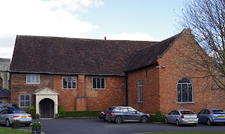
St Anthony's Hall on Peasholme Green, is one of York's four surviving medieval guildhalls. During the siege St Anthony's was an ammunition store, a military hospital and a military prison. Some of the old tables in the Hall are believed to have been used as surgeon's tables for treating the Marston Moor wounded. The Hall currently houses a church and the Quilt Museum and Gallery ( the museum closed a few years ago but can be viewed by appointment).
The now spireless St Deny's Church on Walmgate also suffered damage from the same battery: it's spire took several hits, lightning eventually finishing it off several years later.
The King's Manor was the headquarters of the Council of the North until 1641 and occasional home of the Earl of Strafford. It is now the home of York University's archaeological department. Adjacent to the Manor is York Art Gallery, who have in their collection a contemporary portrait of Lord Ferdinando Fairfax by Edward Bower.
 |
| Photo Credit: York Museums Trust |
The regecide Sir John Bourchier gets a mention on a plaque located on his son's house, Micklegate House.
The Pavement was an ancient marketplace within the city walls; an effigy of Cromwell was burnt here at the Restoration.
Opposite the plaque is the Herbert House - a plaque commemorating the birthplace of Sir Thomas Herbert is located above the entrance to Lady Peckett’s Yard. Sir Thomas sided with Parliament during the war, and became an attendant to King Charles I during his two years captivity. As other attendants were dismissed by Parliament, Thomas eventually became the only gentleman of the bedchamber remaining, until the moment the King stepped on to his execution scaffold. In his memoirs Thomas recalls that the day before he died King Charles gave him a certificate expressing that, ‘Mr Herbert was not imposed upon him but by His Majesty made choice of to attend him in his Bed-Chamber’. He would be instrumental in making arrangements for the King’s funeral.
Some modern historians, writing from a Royalist perspective, are somewhat scathing of Herbert: 'duplicitous' being one of the kinder words used to describe him.
Sir Thomas lived at Petergate House on High Petergate.
The City Walls
A walk around the city walls gives good views of the city; if you are unfamiliar with the city, I recommend seeking out the information boards located at the 'entrances' to the walls. Located on each is a QR code which gives access to multimedia guides to the section of wall you are about to join.
When walking the walls you may notice a number of 'arrow slits' located in the walls: if the 'slits' are just vertical (as opposed to cross shaped) there is a very good chance they are musket loops cut into the walls during the siege. Most appear too low to be useable: they were designed for musketeers to fire from when kneeling down.
The other thing to keep a look out for are musket ball marks, most evident in the areas that saw the most fierce fighting (St Marys Tower, and the section from Red Tower clockwise to the Ouse). Whilst it isn't possible to say that they are definitely musket ball scars (some could just be the result of natural weathering), the high concentration - particularly at Walmgate Bar, and comparison to other known musket ball scarring strongly suggests that they are in all likelihood musket ball scars.
The section of wall that encompass the Yorkshire Museum gardens around to Exhibition Square saw a fierce assault by the Eastern Association in the days prior to Marston Moor. St Mary's Tower was undermined and two mines detonated; the Tower and surrounding walls partially collapsed, allowing Manchester's men to storm through. to their goal of the King's Manor. They met heavy opposition and were repulsed; the defenders were able to shore up the defences. The Tower and wall has since been repaired and rebuilt, but noticeably lower than it would have been.
The section of walls from the Red Tower clockwise around to the river saw probably the most of the ''interesting" action from the siege, being assaulted by the Northern Association. The Red Tower was the end of the walls, to the north was boggy ground and the King's fishpool, so it didn't really need a wall. The Red Tower is now used for a number of community activities. Keep a lookout on this section of walls, as there are a number of musket loops located here. The tower itself sustained extensive damage from the nearby Parliamentarian battery. The defenders bolstered the defences here by digging extensive ditches.
 |
| One of a number cannon ball scars at Walmgate Bar |
Parliament's men would tunnel underneath Walmgate Bar; the defenders got wind of the mining and sunk their own tunnel above the Parliamentarian one, using it to flood the attackers' tunnel with water. There are many musket ball scars on the walls here, possibly some cannonball marks, and it is believed signs of the mining activity.
If you are linking the sites mentioned here into a tour of the city - this is the jumping off point for Lamel Hill, St Lawrence's and the Barbican burial pits.
Continuing in a clockwise direction, cross the River Ouse, and just as you rejoin the walls is Baile Hill. Bailie Hill takes it not from the eleventh century motte and bailey castle that once stood here. The castle had long since gone by the time of the siege, but the large man made mound that is still visible today made an ideal place to serve as a Royalist artillery battery. There are many Civil War 'themed' street names close to Baile Hill.
If you are linking the sites mentioned here into a tour of the city - it is possible to detour via the 'sconce nearest to the towne' > likely site of the parley tent > the Mount before rejoing the walls at Mickelgate Bar.
Continue along the walls and you will eventually come to Mickelgate Bar, which saw desperate scenes when the Royalists returned to the city from Marston Moor. There is a commemorative plaque for the siege (right next to the road); it also features in Victorian paintings of the Royalist retreat from Marston Moor.
Outside the City Walls
For those of you familiar with the city, have you ever wondered why all the beautiful, medieval timber framed buildings are inside the city walls, with very few outside? There are a number of reasons for this, but a significant factor is that the defenders set fire to the buildings outside the walls so as not to afford the attackers cover from the defenders' musket and cannon fire.
Leaving the city walls at Walmgate and heading out of the city you'll find remains of an earthwork on Lamel Hill. This was a battery raised by Lord Ferdinando on 5th June 1644 from which he could bombard the city's defences.
 |
| The footpath to Lamel Hill is accessed through this gate |
 |
| The earthwork is located 100m or so through the gate, and is more easily seen on the ground rather than in pictures (it's the raised section that forms the brow of the hill) |
Lamel Hill can be accessed via a footpath adjacent to 103 Heslington Road. Some on street parking is available. There were four culverins and a demi-culverin sited here: the demi-culverin had been captured from the Royalists at Hull in 1643 and was called the Queen’s Pocket Pistol. The hill is also believed to be a Saxon execution site - a large number of headless skeletons have been excavated from the summit of the hill. Lower down the hill, adjacent to the corner of the imposing brick wall is the site of a Roman execution site too.
Close by is St Lawrence's Church; the church was severely damaged during the siege, and was restored during the Restoration. St Lawrence's was demolished in the nineteenth century and a new church built on the plot, only the tower of the original church remains. This area was captured by Parliament after it had been bombarded by the battery at Lamel Hill. Fairfax would instruct that a battery be established here in order to bombard Walmgate Bar. It is believed that somewhere in the region of 3000 men from the Northern Association camped in this area.
Opposite Fishergate Bar (the next gate you'll encounter after Walmgate if walking in a clockwise direction) is the Barbican Centre; proceed up the path by the side towards the Fire Station on Kent Street. There is a piece of waste ground here on the corner of Kent Street/Fawcett Street, the site of an abandoned medieval church, All Saint's; the site was excavated in 2007/8 and ten mass burial pits were discovered containing a total of 113 bodies. These were ascertained to be the remains of soldiers from Fairfax's army, quite possibly associated with the encampments at St Lawrence's and Lamel Hill. A BBC documentary, part of the History Cold Case series, investigated the remains: the episode, 'The York 113' can be found on YouTube.
Close to Clifford's Tower, cross over the river and head down Bishopthorpe Road to the Methodist church. Originally the site of a windmill, this was the location of a defensive sconce (or star fort), known as the "closest to the Towne'". It is elevated some fifty feet above the Ouse, which came in handy for the Scots who captured it on the 7th June, and used it against the defenders. Surrounded by a double ditch, the sconce housed 120 men. No sign of the fort remains.
Head back towards the city, then turn left down Scarcroft Road to the area of the park (on one side of the road), and allotments (on the other); this is the likely location of the Parley tent, which saw a six hour negotiation of surrender terms in June 1644.
You can carry on down Scarcroft Road, to join Tadcaster Road, then turn left: those of you who drove into York from the south along the A1036, Tadcaster Road, may have had to wait at the traffic lights at the junction with Albermarle Road/Dalton Terrace (there's a hotel called The Mount on one of the corners). This was the site of The Mount, a Royalist defensive sconce. Briefly taken by the Scots it remained in Royalist hands for the majority of the siege. Partially excavated for road widening in the 1750s any remaining evidence of the fort, and the Romano-British cemetery, were erased in the 1950s. It's about a five minute walk along Tadcaster Road to the city walls and Micklegate Bar, from here.
Some other earthwork locations (that don't really fit neatly into the walking the walls route) are Holgate Hill, the likely site of a sconce which was visible until the 1930s when it was levelled for housing. St Peter's School playing fields were the likely location where Sir Henry Slingsby said Manchester "rais'd a battery against ye mannor Wall". Close by, where Water End crosses the Ouse (the other side of the river from the YHA) was the site of a number of Parliamentarian earthworks. Manned by a regiment of dragoons guarding a bridge of boats, they were famously attacked, captured and used by Rupert to relieve the siege
The definitive work on the siege is Wenham's "The Great and Close Siege of York 1644": whilst out of print, it can usually be found at online auction sites or through ABE Books.
Which leads us to the Marston Moor site.
Reasonably well preserved the site is about seven miles from the centre of York on the Tockwith to Long Marston road.
Considering that this is one of the biggest battles to have taken place on English soil there isn't much recognition of the site. There is a memorial obelisk with a new interpretative panel.
A number of rights of way cross the battlefield, and these provide the best way to see the battlefield.
The view from the Royalist lines towards Cromwell's Plump (the tree on the skyline, rising above the hedgerow)
Cooke's "The Civil War in Yorkshire, Fairfax versus Newcastle" has summaries of both the siege, and Marston Moor. It also has walks around both the battlefield, and the City of York.
St Helen's Church in Bilton-in-Ainsty was used as a hospital for Parliamentarian soldiers wounded in the battle. It would later serve as a prison for some of the many Royalists captured on the day. There is believed to be a burial pit, for the many men who the surgeon doctor could not save, in the churchyard. The porch has a crude carving of a crowned snake, believed to have been carved by one of the Royalist captives. The church is usually locked, but a polite enquiry at the Old Vicarage should allow access.
If visiting Marston Moor it is worth taking a slight detour to visit St James' Church Bilbrough, which is the location of Sir Thomas Fairfax's tomb. St James' is one of the churches which makes up the modern parish of Marston Moor. Open daily, please remember that St James' is a working church and behave respectfully when visiting. Parking available on the road outside the church. As well as Fairfax's tomb they have a small number of artefacts from Marston Moor on display.
Whilst visiting the battlefield, if you require refreshments might I suggest the Boot and Shoe Inn in Tockwith? The walls of the pub sport a number of pictures and artefacts (original, but mostly reproduction) from the battle.
Selected Bibliography
The Great and Close Siege of York 1644 P.Wenham, Roundwood Press
The Civil War in Yorkshire, Fairfax versus Newcastle D.Cooke, Pen & Sword
Postcodes for SatNavs
The Great and Close Siege of York 1644 P.Wenham, Roundwood Press
The Civil War in Yorkshire, Fairfax versus Newcastle D.Cooke, Pen & Sword
Postcodes for SatNavs
Merchant Taylors' Hall, Aldwark YO1 7BX
Castle Museum/Clifford's Tower YO1 9RY
Castle Museum/Clifford's Tower YO1 9RY
St Anthony's Hall, Peasholme Green YO1 7PW
St Sampson's Church, Church Street YO1 8BGThursday Market aka St Sampson's Square YO1 8RY
St Deny's Church, Walmgate YO1 9QD
York Minster Y01 7HH
Yorkshire Museum YO1 7FR
Exhibition Square (for Art Gallery & King's Manor) YO1 7EW
Micklegate House YO1 6JXThe Herbert House/The Pavement YO1 9UP
Petergate House, High Petergate YO1 7EN
St Mary's Tower YO30 7WZ
Red Tower YO1 9UJ
Walmgate Bar YO10 4UR
Lamel Hill, access adjacent to 103 Heslington Road YO10 5BH
St Lawrence's Church, Lawrence Street YO10 3WP
Barbican car park (very close to All Saint's burial pits), Kent Street YO10 4AH
Baile Hill YO1 6HF
Micklegate Bar YO1 6JU
Sconce closest to the Towne, Bishopthorpe Methodist Church, Bishopthorpe Road YO23 1NX
Likely location of Parley Tent, Scarcroft Road YO23 1NF
The Mount YO24 1GU
Holgate Hill, Wilton Rise YO24 4BT
Manchester's Battery, St Peter's School YO30 6AB
Parliamentarian Earthworks, Water End YO30 6LP
Marston Moor memorial YO26 7PJ
St Helen's Ancient Church, Bilton-in-Ainsty YO26 5NL
Old Vicarage, Bilton-in-Ainsty YO26 7NN
St James' Church, Bilbrough YO23 3NT
Boot and Shoe Inn, Tockwith YO26 7PR
Zoomable map with all points mentioned, marked upon on it 👇
Rupert's March North
Part 1
Part 2
Part 3
Part 1
Part 2
Part 3
If you enjoyed reading this, or any of the other posts, please consider supporting the blog.
Thanks.






Comments
Post a Comment